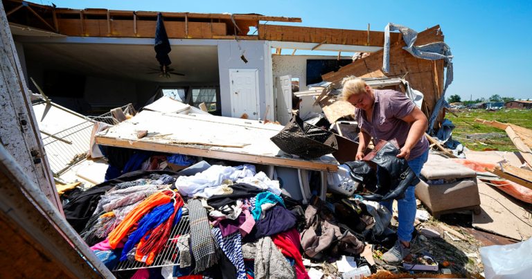
Communities from Texas to New York were grappling with recovery efforts Tuesday after tornadoes, storms and heavy rains brought by a devastating holiday weekend that left at least 24 people dead and left hundreds of thousands without power.
The severe weather isn’t over in Texas, with powerful and potentially destructive storms possible through Tuesday. More than 780,000 power customers were without power Tuesday morning, according to Poweroutage.us.
The National Weather Service in Kentucky and Arkansas sent teams to survey the wreckage, and they found damage equivalent to an EF3 tornado, the third highest rating on the Modified Fujita Scale, which measures tornado strength, equivalent to maximum wind speeds of 165 mph.
The National Weather Service in Paducah, Kentucky, said it was consulting with internal experts on whether the tornado should be classified as an EF4, the second-highest rating used when wind speeds range from 166 to 200 mph.
Drone camera footage showed the extent of the storm’s damage in Paragould, Arkansas, with homes losing roofs and some buildings almost completely destroyed.
The National Weather Service damage assessment team in Louisville, Kentucky, confirmed two EF1 tornadoes with maximum wind speeds of 90 mph touched down on Sunday.
Though some power lines have been repaired, more than 200,000 electricity customers were without power across Texas and the Midwest, and 82,000 connections were lost in Kentucky, according to PowerOutage.us.
There were ground stops at Dallas-Fort Worth International Airport and Dallas Love Field on Tuesday morning.
Ground stoppages at Hartsfield-Jackson Atlanta International Airport added to travel chaos over the holiday weekend, with delays at the airport briefly topping 5,000 Sunday night, according to FlightAware.com’s so-called “Misery Map.”
The Transportation Security Administration said Friday was the busiest day ever at U.S. airports, with 3 million passengers screened, beating last year’s Thanksgiving record. AAA also estimated that about 38 million drivers were on the roads over the weekend, also a record.
Heavy rains pounded Iowa on Memorial Day, reducing visibility to almost nothing, and golf-ball-sized hailstones were seen pounding cars in the Dallas suburb of Oak Cliff, Texas, according to videos on social media.
Texas is bracing for “strong to severe” storms expected across much of the state on Tuesday that could bring significant damaging winds and large hail, the weather service said in a forecast. At least 25 million people, including parts of Oklahoma, are under some sort of weather warning.
“Additionally, merging storm cells and clusters will likely produce rainfall amounts heavy enough to cause multiple flash floods, especially in areas west of Dallas-Fort Worth and north of Austin,” the report said.
Thunderstorms and flash flooding could be dangerous from South Texas to the Gulf Coast, the agency said in a memo.
Videos posted on social media showed high winds and heavy rain in Lewisville, Texas, about 28 miles from Dallas.
A hailstorm raged so hard in Hurst, Texas, in the Dallas-Fort Worth metropolitan area on Monday that it caused the roof of a Walmart store to crack, forcing shoppers to use nearby items for shelter, according to a video posted to Instagram.
The heatwaves that have seen triple-digit temperatures hit much of Texas and the Gulf Coast over the past few days are finally easing, but the perceived heat index could still reach 115 degrees on Tuesday, the weather service said.
In Jackson County, Colorado, rancher Mike Morgan and his 34 cattle were killed by lightning on Monday, but county officials and neighbors said he will be “deeply missed.”
“This isn’t just about my family. This is about the larger community of Jackson County,” rancher Janie VanWinkle told Denver NBC affiliate KUSA.
For the rest of this week and beyond, the first signs are that this hectic and historic tornado season (461 tornadoes were reported in May alone) is winding down.

